
Blog · Aerial Mapping
Why Large-Acreage Aerial Mapping Requires More Than a Flight Plan
Large-acreage aerial mapping is not a bigger version of a small-site job. Zone tracking, altitude restrictions, and organized delivery are what make the difference between a successful multi-zone mission and a folder of unsorted imagery.
Last updated: July 14, 2026
In This Guide
- Acreage Alone Does Not Tell the Whole Story (jump to section)
- How Altitude Restrictions Change the Work (jump to section)
- When the Mission Sits Near Controlled Airspace (jump to section)
- Why KML Zones Need Field Tracking (jump to section)
- The Field Log That Keeps the Mission Honest (jump to section)
- Organized Delivery Starts Before Upload (jump to section)
- Cross-Site Workflow: When the Mission Spans Two Counties (jump to section)
- Frequently Asked Questions (jump to section)
Many people think aerial mapping is simple: draw a boundary, fly a grid, upload the imagery. On small sites, that approach is often close enough. On large-acreage sites, especially near controlled airspace, the job becomes an operational one. The work has to be planned by zone, altitude, access, and deliverable requirements before the aircraft is ever powered on.
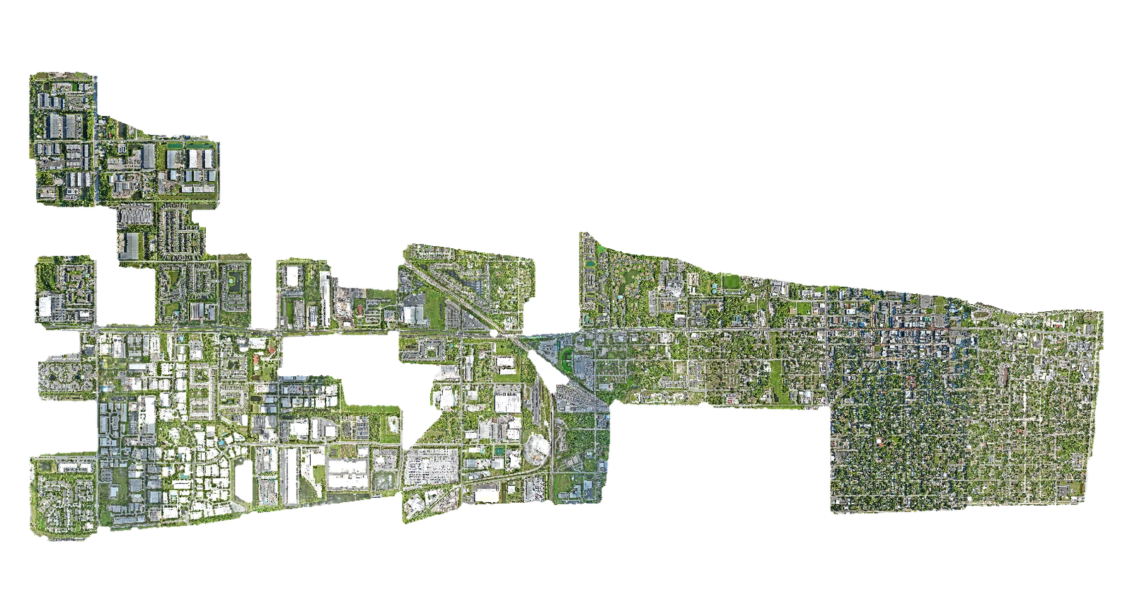
This article pulls the working details out of a real multi-zone mapping mission in Central Florida: 27 named KML zones split across a 200 ft restricted group and a 300 ft primary group, captured at altitudes set by proximity to controlled airspace, organized into zone-based folders, and delivered as more than 14,000 files across approximately 64.5 GiB of imagery. The takeaway is not a single trick. The takeaway is that large-acreage aerial mapping is a field operation, and the quality of the final deliverable depends on planning, tracking, and organization as much as the flight itself.
Acreage Alone Does Not Tell the Whole Story
A 2,000-acre mission is not a bigger version of a 200-acre mission. The same plan that works at 200 acres falls apart at 2,000, because the failure modes change.
More acreage means more launch planning. Every additional battery cycle is a full ground setup: preflight, takeoff, mid-flight checks, landing, battery swap, and the next launch. The cumulative cost of those cycles is not linear. A mission that needs four batteries in the air covers less than four times the area of a mission that needs one battery, because the swap, setup, and repositioning time compounds.
More acreage means more flight segments. Each KML polygon in a multi-zone mission is its own flight segment with its own flight lines. A 27-zone mission has 27 distinct flight segments, even if some of them are back-to-back. The mission plan, the field log, and the post-flight folder structure all have to reflect that segmentation, not flatten it.
More segments mean more image management. A single 200-acre site might produce a few thousand images. A 2,000-acre multi-zone site can produce 10,000 to 20,000 images. Without an organized folder structure and a written field log, image management becomes the dominant time cost of the project.
Access points can affect the entire day. Where the pilot sets up is a function of where the access is. On a multi-zone mission spread across a county, the choice of access points drives how the zones get grouped into field sessions, which in turn drives the flight plan, which in turn drives the battery cycling. Treat access as a planning input, not a logistics afterthought.
Weather windows matter more. A small site can be re-flown the next morning if weather closes in. A 2,000-acre multi-zone mission cannot, because the multi-day delay breaks the field session and the schedule. Weather windows have to be planned for in advance, not reacted to on the day.
How Altitude Restrictions Change the Work
A 200 ft AGL mapping zone takes more time than a 300 ft AGL zone covering the same acreage. At lower altitude the aircraft covers less ground per pass, which means more flight lines, more images, more battery usage, and more time in the field per acre.
On a mixed-altitude mission with both 200 ft and 300 ft zones, the lower altitude work is often the schedule driver. Treating a mixed-altitude mission as if it were single-altitude is one of the most common planning mistakes. The fix is to split the zones by altitude group before estimating duration, not after.
For example, on a recent Central Florida mapping project the 200 ft group covered 15 named zones and the 300 ft group covered 12. The 200 ft group, despite being roughly comparable in acreage, required more flight time, produced more images per zone, and ran more batteries per session. Planning those two groups as separate work blocks rather than one continuous mission was what kept the schedule realistic.
Altitude also affects the resolution of the final output. A 200 ft capture produces imagery with a smaller ground sampling distance, which means more detail per acre. That higher resolution is useful for some applications (planning, as-built verification, granular site features) and is overkill for others (broad-acre visualization, regional context). The mission plan should match the capture altitude to the intended deliverable.
When the Mission Sits Near Controlled Airspace
When the site sits near an airport or controlled airspace, the flight plan has to respect approved altitude ceilings. That constraint is not optional, and it produces a specific kind of mission structure: zones that can be flown at 300 ft AGL, and zones that have to be flown at 200 ft AGL, separated geographically but managed as one overall capture.
The practical effect is that the mission becomes two parallel capture streams. The 300 ft zones move faster, but they still have to be tracked cleanly by zone. The 200 ft zones move slower and produce more imagery per acre. The receiving team gets a single deliverable that contains two different altitude groupings, and the folder structure and the field log have to reflect that split so the downstream review can distinguish between them.
A useful side effect of the split is that the field log can use altitude as a primary key alongside zone name. Anything tagged with altitude as a structural column (not just a note) makes the post-flight review and QA faster. The receiving team can pull the 200 ft group and the 300 ft group independently, and any future re-flight work is simpler because the altitude grouping is already explicit.
Why KML Zones Need Field Tracking
For a small mapping job, one or two KML polygons are easy to keep in working memory. For a large mapping job with dozens of named zones, the working memory approach fails. The pilot cannot remember which zones have been flown, which are in progress, which still need a re-flight, and which have field notes tied to them.
The KML set is the source of truth for what gets captured. The field workflow has to mirror that source of truth, not approximate it. A simple per-zone field log, written as each zone is completed, ties the actual flight activity to the planned zone list and produces an audit trail the receiving team can use.
A useful pattern is to treat zone name as the row identifier in the field log. Every row gets a zone name, an altitude, an acreage, a start time, an end time, a status, and a notes field. The notes field is where re-flight reasons, access issues, no-fly notes, and weather holds land. The status column is what makes the field log useful as a working document: it tells the pilot what is left, what is done, and what is in progress, without re-reading the entire log.
The Field Log That Keeps the Mission Honest
The point of a field log is not paperwork. The point is avoiding confusion in the field and producing an audit trail after the fact. A field log that is over-engineered (a dozen columns, dropdown menus, three status fields per row) will not get used in the field. A field log that is too thin (a single column for everything) will not produce useful post-flight data.
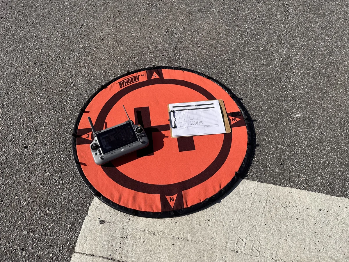
The columns that earn their place in a real field log: zone name, altitude, acres, start time, end time, status, and notes. Everything else is optional. Battery counts, card segment numbers, upload status, and similar housekeeping can live in a separate column or be inferred from filenames and timestamps. The field log should fit on one or two printed pages, and the columns should be the ones a pilot can fill in from the truck or the launch site, not the ones the office would like to have.
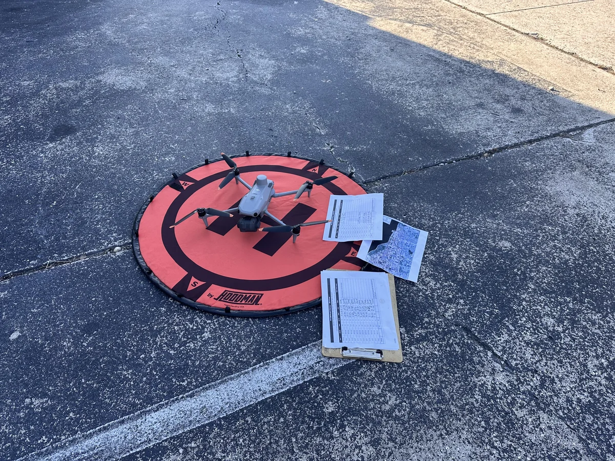
A useful practice is to update the field log as each zone completes, not at the end of the day. End-of-day log updates are the most common source of dropped zones, swapped start and end times, and missing field notes. Mid-zone updates are more accurate and take less total time because the information is fresh.
The field log also doubles as the QA reference for the post-flight processing. If a zone's imagery looks off (a gap, an over-exposure, an unexpected shift), the field log's notes column is the first place the processing team looks to understand why. A photo log entry that says "Note: mid-zone wind shift, partial capture" tells the processing team what to expect; the absence of such a note means the team has to guess.
Organized Delivery Starts Before Upload
The final upload is the moment the mission becomes a deliverable. A messy upload forces the receiving team to spend hours reconstructing what should have been obvious from the folder structure. A clean upload takes minutes to review because the structure does the work.
Original filenames retained. Renaming thousands of aerial images mid-mission is a recipe for lost work. Keep the original DJI filenames. They contain timestamps, sequence numbers, and a few other attributes the receiving team can use, and they preserve the chain of custody from capture to deliverable.
Zone-based folders. Each named zone gets its own folder. The folder name should be the KML zone identifier so the receiving team can map the imagery directly back to the planning documents. A flat folder with thousands of images is the single most common delivery mistake and is worth avoiding every time.
Inventory and manifest. Before upload, the field team produces a manifest: a simple text or spreadsheet list of every zone, its image count, and its total file size. The manifest is the QA tool that catches missing segments, partial uploads, and zone miscounts before the receiving team finds them. A manifest with a row per zone and a column for image count takes ten minutes to produce and saves hours of downstream QA.
Split by altitude group. When the mission has mixed altitudes, the top-level folder structure should reflect that. Two parent folders (200 ft group, 300 ft group), each containing their zone subfolders, makes the altitude split explicit and reviewable. The alternative, mixed altitudes in one flat structure, forces the receiving team to derive the altitude split from filenames or metadata, which is slow and error-prone.
The end state is a deliverable the receiving team can review by zone, with no reconstruction work. A clean deliverable is also reusable: a future re-flight of a single zone can be inserted into the existing folder structure without disrupting the broader organization.
Cross-Site Workflow: When the Mission Spans Two Counties
When a mission spans two physical sites, the work is no longer one continuous mapping job. It is two mapping jobs managed as one overall delivery, and the field log has to reflect that. The same columns work (zone, altitude, acres, start time, end time, status, notes), but the log needs a top-level site column so the receiving team can split the final deliverable back into its component parts.
For a recent two-site mission in Central Florida, one site covered approximately 358 acres across four zones in the Ocala and Marion County area, and the other covered approximately 799 acres across seven zones in the Beverly Hills and Citrus County area. Total combined acreage was approximately 1,158 acres across eleven zones, all flown at 300 ft AGL. The two sites had different access points, different terrain, and different timing, but the per-zone capture discipline was identical.
The cross-site pattern that worked: capture the first site to completion, then move to the second site, with a fresh field log for each. The receiving team gets two top-level folders, each containing zone subfolders and a manifest, both delivered as a single upload. Two short field logs are easier to keep accurate than one long one, and the audit trail stays clean.
The Real Difference
A professional aerial mapping execution is not defined by the aircraft. It is defined by the planning, the altitude handling, the zone tracking, the field log discipline, and the organized delivery. The aerial platform is one component. The other components are what make a multi-zone mission produce a deliverable the receiving team can review, instead of a folder they have to reconstruct.
For projects where the deliverable will be reviewed by a surveyor, an engineer, an owner, or a stakeholder team, the organized delivery and the audit trail are not optional. They are the answer to the question the receiving team will ask the first time they open the upload: where do I start, and how do I know everything is here.
For more on the orthomosaic output that the aerial imagery feeds into, see the Aerial Orthophoto Mapping service page. For an example of what a single-zone mapping deliverable looks like when it also includes per-pile volume work, see the Citrus Stockpile Volume and Tonnage Mapping case study.
Frequently Asked Questions
Why is large-acreage aerial mapping different from a small-site mapping job?
A small mapping job can usually be flown in a single launch with one battery cycle and a single grid. A large-acreage mapping job, anything from a few hundred to several thousand acres, is a multi-launch operation. It requires planning by zone, altitude, airspace, access points, and deliverable requirements. The same plan that works at five acres falls apart at 2,000, because the failure modes are different: battery cycles stack up, captured imagery has to be tracked by zone, file counts climb into the tens of thousands, and the receiving team needs a folder structure that lets them review the work, not a flat dump.
How does altitude restriction change the work on a large mapping mission?
A 200 ft AGL capture zone takes more time than a 300 ft AGL zone covering the same acreage. At lower altitude the aircraft covers less ground per pass, generates more flight lines, produces more images, and consumes more battery per acre. On a mixed-altitude mission with both 200 ft and 300 ft zones, the lower altitude work is often the schedule driver, and the mission plan has to account for it explicitly. Treating a mixed-altitude mission as if it were single-altitude is one of the most common planning mistakes.
What is the role of KML zones in a large aerial mapping mission?
KML polygons define the areas to be flown. For a small site there might be one polygon. For a large mapping mission there might be dozens, each with its own acreage, altitude assignment, and access constraints. The KML set is the source of truth for what gets captured, and the field workflow has to track each zone individually so nothing gets missed and nothing gets flown twice.
Why is a field log useful on a large mapping mission?
Without a written record, it is easy to lose track of which zones have been completed, which are in progress, which still need a re-flight, and which have field notes tied to them (no-fly notes, access issues, weather holds). A simple field log with columns for zone name, altitude, acres, start time, end time, status, and notes prevents that. The log is also the audit trail that ties the final delivered imagery back to what actually happened in the field.
How should the imagery be organized for delivery after a large mapping mission?
Organized by zone and flight segment, with original filenames retained, and a manifest that confirms image counts and folder completeness. A flat folder with thousands of images is the single most common delivery mistake. It forces the receiving team to spend hours reconstructing what should have been obvious from the folder structure. A properly organized delivery has each zone in its own folder, original DJI filenames preserved, a flight log, and a simple text manifest listing every zone with its image count.
Is aerial mapping the same as a survey?
No. Aerial mapping produces documentation and planning grade outputs that are appropriate for as-built records, wayfinding, stakeholder reports, marketing collateral, and operational decision support. It is not a substitute for a licensed surveyor with survey-grade equipment when the work requires certified elevations, property boundaries, or stamped engineering quantities. Aerial mapping and survey-grade work are complementary tools, and the right one depends on what the deliverable will be used for.
How long does a large-acreage aerial mapping mission take in the field?
It depends on acreage, altitude mix, zone complexity, weather windows, and battery cycle logistics. A multi-zone mission in the 1,000-2,500 acre range with mixed altitudes typically runs one to three field days for one pilot, plus pre-flight planning time and post-flight processing. Smaller single-altitude missions can be completed in a single day. Larger or more complex missions add days. The honest answer is that acreage alone does not determine duration: a 2,000-acre mission at constant 300 ft AGL is materially faster than a 2,000-acre mission with half the zones restricted to 200 ft.

Related Posts
How Private School Campuses Use Aerial Wayfinding Imagery
A practical guide for school administrators and marketing directors on orthomosaic imagery.
From Volume to Tonnage: Aerial Stockpile Measurement
How aerial photogrammetry becomes a decision-support report.
How Aerial Roof Condition Reports Work
A practical guide for property managers on aerial existing-conditions roof reports.
Request a Large-Acreage Mapping Project Assessment
Tell us about the site, the zones, and the deliverable. We will confirm fit, recommend a scope, and provide a quote within 48 hours.
Contact Us