
Service
Construction Documentation Services for Commercial Projects in Florida
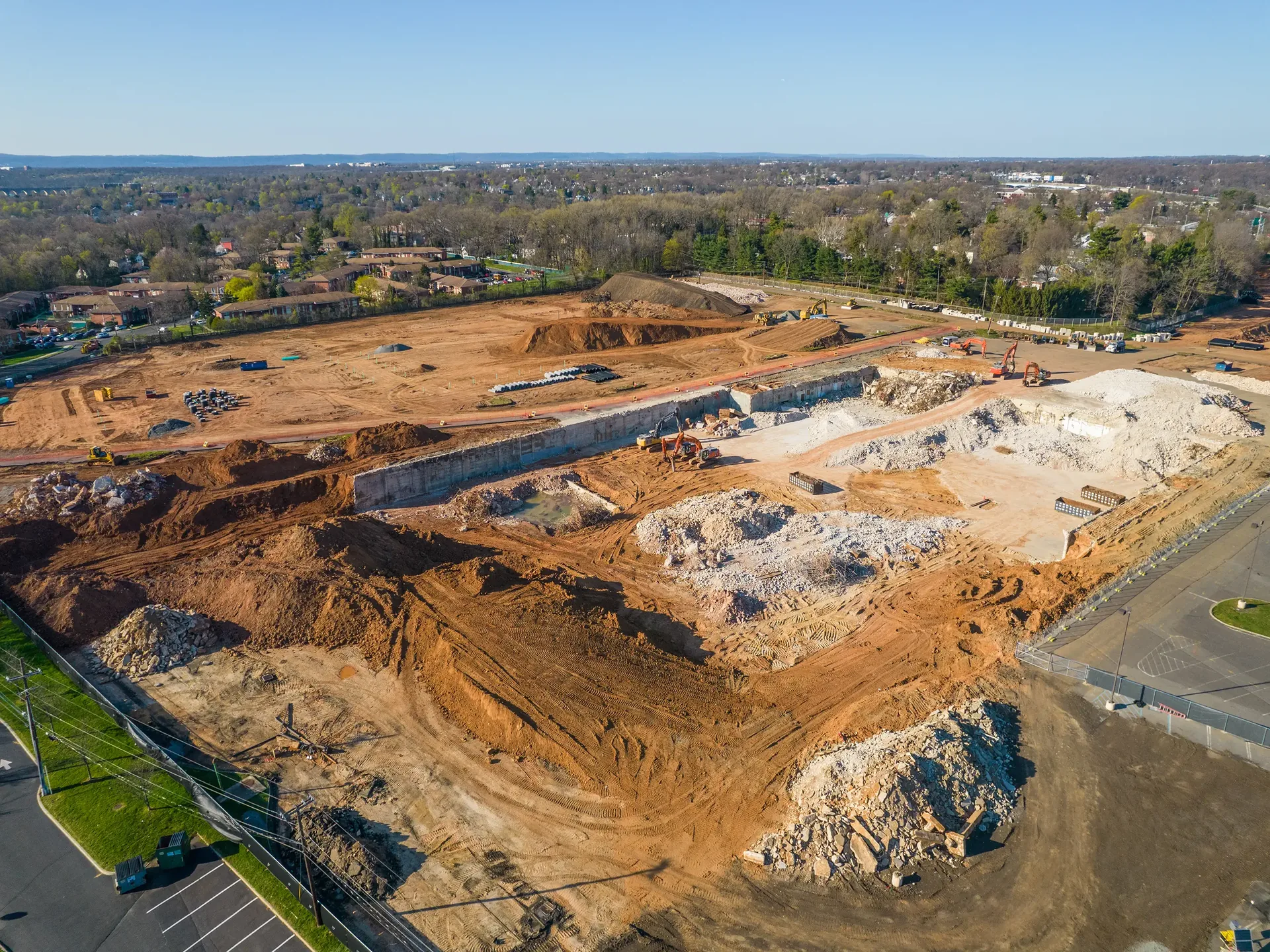
Aerial photography, existing conditions surveys, preconstruction site surveys, and lender documentation packages for commercial general contractors, developers, and construction managers. 48-hour turnaround. Project-based pricing.
How It Works
Tell Us About Your Site
Project location, scope, timeline, and what documentation you need. We confirm fit and recommend a service mix.
We Show Up On Site
Single sweep, ongoing monitoring, or full time-lapse installation. FAA-certified, $1M insured, jobsite-safe.
You Get the Deliverable
Photos, reports, time-lapse video, orthomosaics. Delivered within 48 hours of the visit, ready to share with stakeholders.
Records and Follow-Up
Every visit produces a dated, geo-tagged archive suitable for bank draws, owner updates, and project records. Available for the life of the project.
What Is Construction Documentation?
Construction documentation is the structured record of what is happening on a construction site over time. It includes dated, geo-tagged aerial and ground photos, a written narrative of what was observed, the raw image archive, and any optional add-ons like orthomosaics, 3D models, or stockpile volumetrics.
Aerial photography, by contrast, produces pretty pictures without structure, dates, or context. The difference matters when the documentation needs to be referenced, shared with stakeholders, or audited months or years after the project is complete. Construction documentation is the format that holds up to scrutiny.
The market for construction documentation in Florida is dominated by general contractors, developers, construction managers, and survey firms. Our services are designed to fit the workflows of each: GC progress reporting, developer stakeholder communication, construction manager multi-site reporting, and surveyor existing conditions and reality capture.
Four Sub-Services
Aerial Construction Photography
Site context, marketing imagery, dated aerial records. Single visits and ongoing cadence.
Existing Conditions Documentation
Pre-mobilization records for surveyors, GCs, developers. Site captured in its current state with dated, geo-tagged imagery.
Preconstruction Site Survey
High-resolution site models and photo sets before mobilization. Used for pre-bid, permit packages, and pre-construction stakeholder communication.
Lender Documentation
Dated, geo-tagged progress records for construction loan draws. Packaged with your draw request or handed off directly to the lender.
Related Services
Construction documentation often pairs with one or more of our other service pillars. Most commercial projects engage us on at least two.
Time-Lapse Documentation
Recurring site visits compiled into a final 2-5 minute video at substantial completion. From $1,200/month retention.
See plans and pricing →
Progress Monitoring
Weekly, bi-weekly, or monthly aerial visits with structured per-visit reports. Starting at $375/visit.
See cadences and pricing →
3D Modeling and Reality Capture
Photogrammetry, point clouds, orthomosaics, and volumetrics. Files drop into AutoCAD, Revit, Civil 3D.
See file formats →
Frequently Asked Questions
What is construction documentation?
Aerial and ground captures of a construction project, structured as dated and geo-tagged photos with a written report, used for stakeholder updates, lender draws, owner reporting, and project records.
How is construction documentation different from aerial photography?
Aerial photography produces pretty pictures. Construction documentation produces a structured deliverable: dated, geo-tagged photos organized in a report that can be referenced, shared, and audited months or years after the project.
What types of projects do you work on?
Commercial construction: offices, retail, hospitality, multi-family, industrial, and infrastructure. We work with general contractors, developers, construction managers, and survey firms on projects typically $5M and up.
What does the deliverable look like?
A stakeholder-ready PDF report with dated and geo-tagged photos, a written narrative of what we observed, the raw image archive, and a private share link. Optional add-ons: orthomosaics, 3D models, stockpile volumetrics.
How quickly do you deliver?
48-hour turnaround on standard visits. Same-day response on most visits in the Orlando service area.
How often do you visit a site?
Depends on project cadence: single sweep, weekly, bi-weekly, or monthly. We tailor the cadence to what your project needs. Most commercial projects run weekly or bi-weekly.
What is the cost of construction documentation?
Single visits start at $450 for an Orlando-area site. Ongoing monitoring runs $375/visit on a recurring schedule, or $1,200/month for a monthly retention.
Can you support lender draws and bank reporting?
Yes. Dated, geo-tagged photo reports are exactly what construction lenders need at each draw. We structure reports so the lender sees dated progress, geo-located images, and a written narrative that backs the draw request.
Do you work on existing conditions surveys?
Yes. Pre-mobilization existing conditions documentation for GCs, developers, and surveyors. We capture the site in its current state with dated, geo-tagged aerial and ground imagery.
Are you FAA-certified and insured?
Yes. FAA Part 107 Remote Pilot, OSHA-10, $1M aviation liability, 500+ flight hours. We carry the same certifications and insurance that commercial clients and their lenders expect.
How much does construction documentation cost in Florida?
Construction documentation pricing in Florida depends on visit count, deliverable type, and site size. Aerial photography visits start at $385 per visit with a 48-hour turnaround. Existing conditions surveys start at $750. Lender documentation packages are quoted per project. Most commercial projects spend $1,500 to $6,000 on construction documentation over the life of the build.
What is the difference between construction documentation and progress monitoring?
Construction documentation is the broader category: any structured record of a build, including aerial photography, existing conditions surveys, preconstruction surveys, and lender documentation packages. Progress monitoring is a recurring subset of construction documentation: scheduled site visits on a fixed cadence (weekly, bi-weekly, or monthly) to capture change over time. We offer both as distinct services with different deliverables.
Do I need construction documentation for a small commercial project?
It depends on who is on the other end of the project. If the lender requires documented progress for draws, yes. If the owner wants visual records for future reference, yes. If the GC is managing multiple sites and needs remote visibility, yes. For single-visit projects with no lender or owner reporting requirement, a one-time aerial photography visit may be enough.
Contact Us
Tell us about your project. We will confirm fit and recommend a documentation plan.
Contact Us