

Construction Documentation
Aerial Construction Photography for Commercial Projects
Aerial photography for construction projects: site context, marketing imagery, dated aerial records. Single visits and ongoing cadence. 48-hour turnaround on standard visits.
Contact UsWhat Is Aerial Construction Photography
Aerial construction photography is the foundation of our construction documentation service. We use commercial aircraft to capture the project site from above, producing a set of dated and geo-tagged aerial photos that document the project from any angle.
Unlike aerial photography for marketing, aerial construction photography is structured for use in stakeholder reports, lender draw packages, owner updates, and project records. The photos are dated, geo-tagged, and organized in a stakeholder-ready PDF with a written narrative of what was observed.
Explore an Aerial Capture in 360°
Equirectangular aerial panoramas capture the full 360-degree view from a single drone position. Click the button below to launch the interactive viewer. The same capture that powers the static panorama above can be panned, tilted, and zoomed in the browser.

Contract aerial capture · Central Florida · 360° interactive viewer
What Aerial Construction Photography Captures
Single aerial visits capture more than the 360° view. The oblique-angle photos below are from contract work across Central Florida, showing what an aerial visit produces at different phases of a multi-phase commercial build.
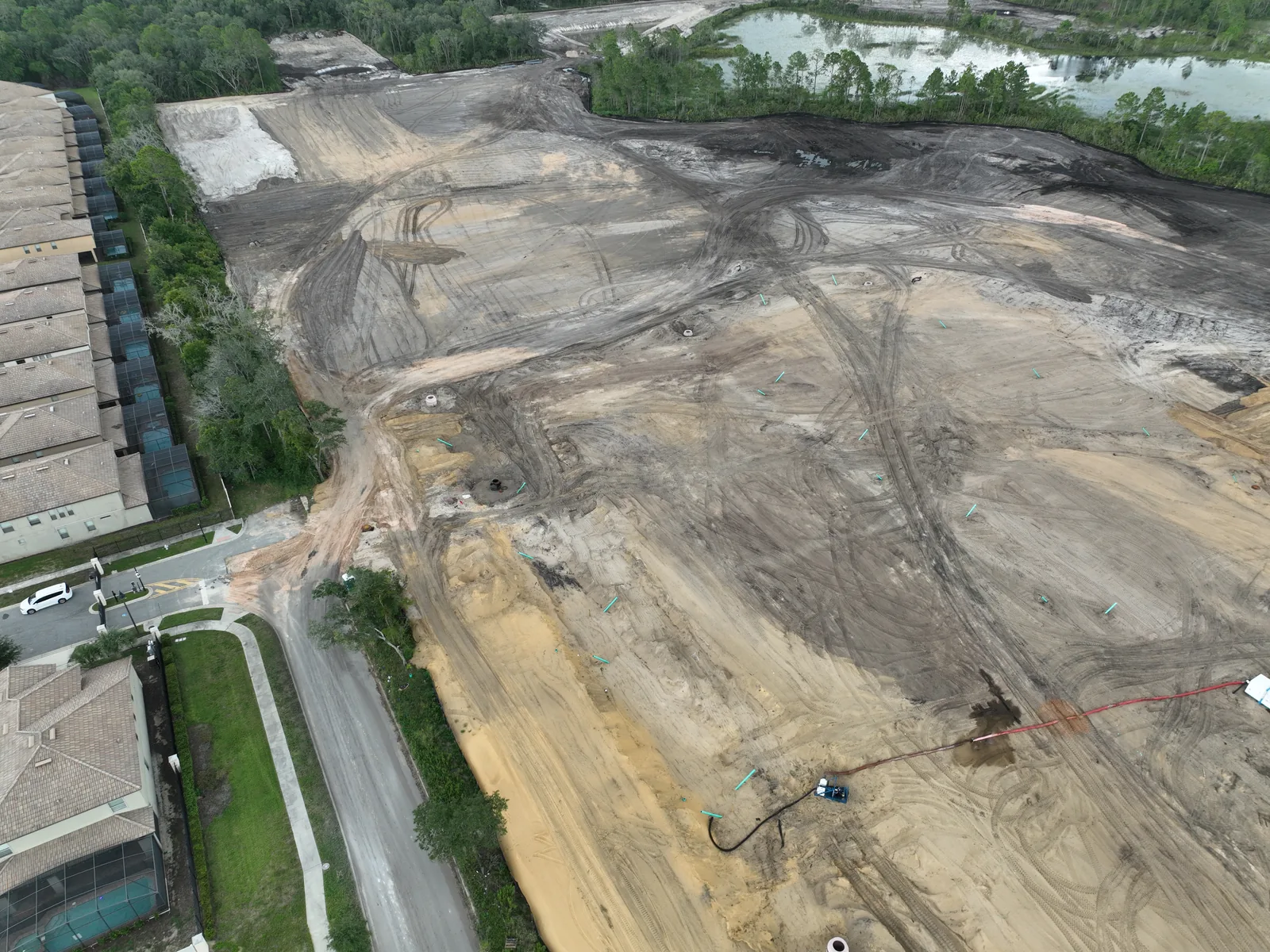
Mass earthwork and grading phase. Active site transformation captured from a single oblique aerial angle.
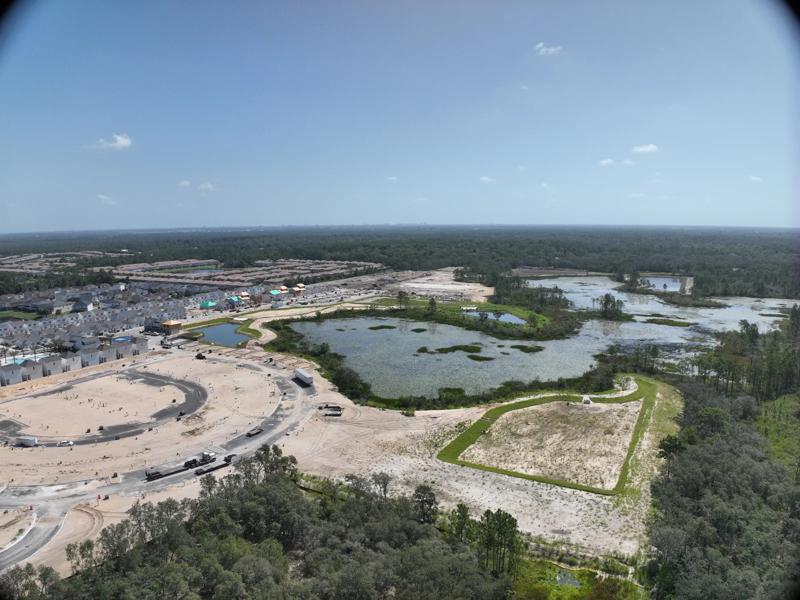
Mid-phase development. Finished neighborhoods adjacent to active earthwork on the next phase.
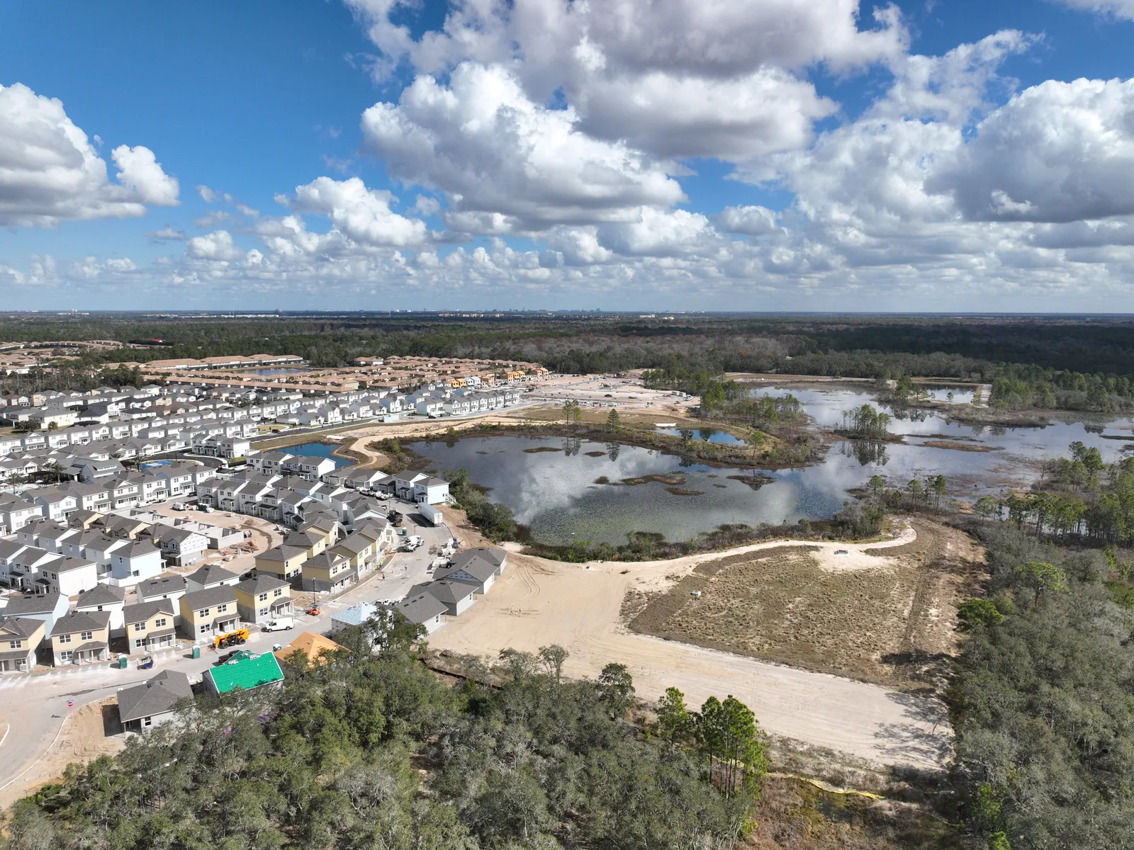
Later phase on the same project. Photographic record of progress between two aerial visits on the same engagement.
When to Use Aerial Construction Photography
Single visits: a one-time capture for a milestone event, permit package, marketing shoot, or stakeholder presentation. The deliverable is a curated photo set plus a written narrative.
Recurring cadence: scheduled visits on a fixed cadence (weekly, bi-weekly, or monthly) as part of a progress monitoring engagement. Each visit is its own deliverable.
Existing conditions: pre-mobilization captures of the site in its current state, used for pre-bid, permit packages, and pre-construction stakeholder communication.
Related Services
Aerial construction photography is the entry point for several other documentation services. Most projects we work on combine photography with one or more of these.
Progress Monitoring
Recurring aerial visits on a weekly, bi-weekly, or monthly cadence. Dated and geo-tagged photos delivered in a structured report. The right cadence for active commercial projects with stakeholder updates and lender draws.
Orthophoto Mapping
Geometrically corrected full-site aerial maps for documentation, planning, and base-map use. The orthomosaic at every visit is a dated record of the site at that point in the build.
Pre-Construction Survey
Existing-conditions capture before mobilization. The pre-construction baseline that subsequent visits are compared against. Required for pre-bid documentation and pre-construction stakeholder packages.
Frequently Asked Questions
What is the cost of aerial construction photography?
Single visits start at $450 for an Orlando-area site. Recurring visits are $375/visit on a scheduled cadence. Volume discounts for ongoing engagements.
How quickly do you deliver?
48-hour turnaround on standard visits. Same-day delivery available for bank draw deadlines, insurance claims, and other urgent needs.
What format are the photos in?
Dated, geo-tagged JPGs at full resolution. Organized in a stakeholder-ready PDF with a written narrative of what we observed. The raw image archive is included.