
Case Study · Volume Calculations
Citrus Stockpile Volume and Tonnage Mapping for Biotech Applied Research in Central Florida
Aerial mapping, per-pile volume measurements, and a tonnage report for a 501(c)(3) citrus nonprofit on a 300-acre Central Florida grove. The data enabled precise scheduling of the Tigercat 6040 mobile carbonizer deployment and equipment rental against the actual material quantity on the ground.
Client
Biotech Applied Research
Location
Central Florida
Site Area
~300 acres
Year
2025
The Project
Biotech Applied Research is a 501(c)(3) nonprofit operating in the Central Florida citrus industry. The organization had a material-processing need across a 300-acre grove property: significant quantities of dead citrus trees, brush, and root wads had accumulated on-site and needed to be cleared, processed, and disposed of in a planned, accountable way.
Zack Farr, the lead on the project, reached out to Skyland Pixels to capture aerial mapping data of the material spread across the property. The deliverable needed to be more than pretty aerial photos. The organization needed per-pile volume measurements, total material tonnage estimates, and a written report they could use for internal planning, equipment scheduling, and reporting to their board and stakeholders.
The aerial capture used an RTK-equipped aircraft, which records centimeter-accurate positional data for each image as it is captured. RTK (Real-Time Kinematic) positioning means each photo's coordinates are known to within a few centimeters without requiring a separate ground control point survey on the ground, which is what allowed the per-pile volume accuracy to be within roughly 1-2% of the true pile volume across the property.
This was a pro bono engagement. Skyland Pixels provided the aerial mapping, the per-pile volume calculations, and the tonnage report at no cost as part of our work supporting Central Florida agricultural and environmental projects.
The Numbers
The aerial mapping and processing pipeline produced the following measurements from the project data:
47
Individual measurements taken across the property, including 12 named stockpiles and 35 row measurements.
3.27
Acres of brush material surface area documented across the grove.
298
Tons of dry material documented, with an estimated 387 tons at 30% moisture content.
The Site
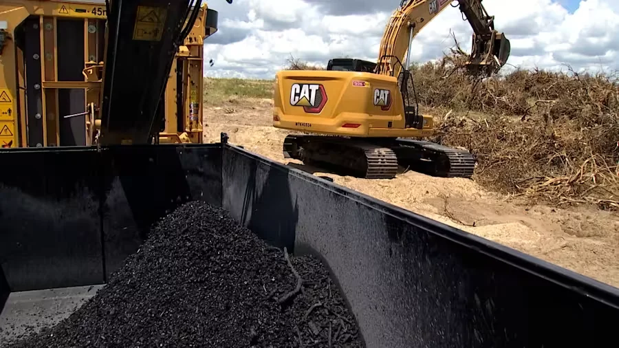
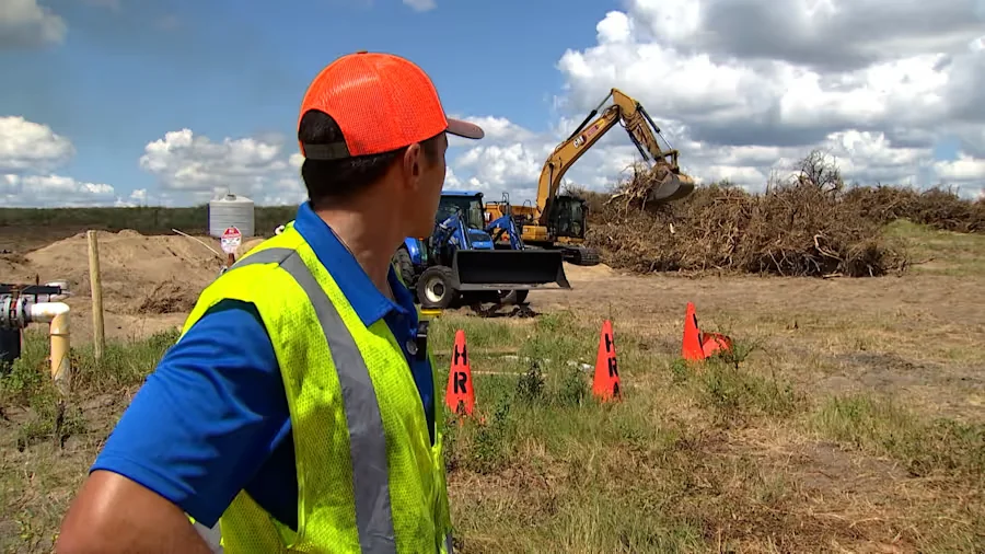
A site supervisor in safety gear oversees brush-sorting operations at a rural Central Florida burn site. A CAT excavator and a tractor sort a substantial pile of woody debris, with safety cones and a water tank staged nearby. Material staging of this kind is typical on rural land-clearing projects where a 45-ton horizontal grinder and a mobile carbonizer will be deployed for processing.
The Processing Operation
On-site processing of the cleared material used a 45-ton horizontal grinder to reduce woody citrus brush to chips and mulch, with a Tigercat 6040 mobile carbonizer deployed separately on a planned schedule for material that could not be processed through the grinder. The combination of equipment allowed the nonprofit to clear the 300-acre property without shipping material off-site.
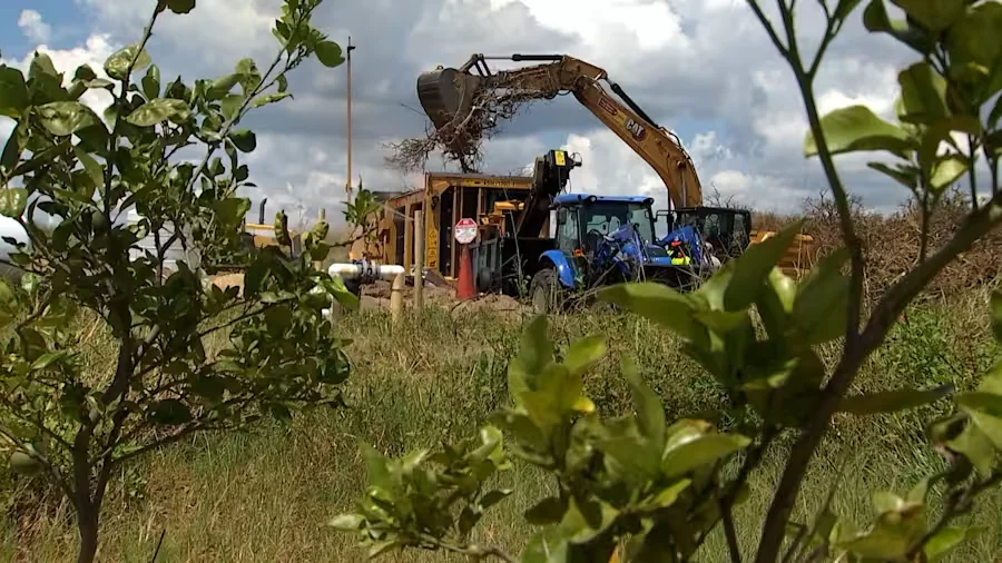
A CAT excavator feeds woody citrus brush into a blue tractor-pulled tub grinder at the burn site. The grinding operation processed cleared material from the grove during the project.
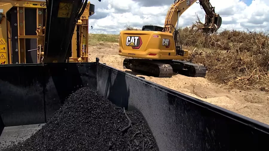
A CAT 336 excavator works a large pile of citrus brush at the grinding operation. Output from the grinding process accumulated in the dark metal bed in the foreground.
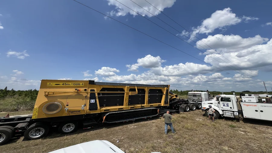
The mobile Tigercat 6040 Carbonizer, a biochar production unit, staged for deployment on the site. Scheduled separately from the grinder, it handled material that could not be processed into chips or mulch.
The Outcome
The tonnage and volume report gave Biotech Applied Research three things they did not have before:
Precise Carbonizer Scheduling
The Tigercat 6040 mobile carbonizer deployment was scheduled against the actual tonnage on the property, not rough estimates. The organization knew the exact volume of material the carbonizer needed to process, which meant the deployment could be sized to the workload, scheduled for the right duration, and tracked against real progress.
Right-Sized Equipment Rental
Equipment rental duration was planned against the measured material quantity, not against an estimate. The organization paid for the right amount of equipment time, neither over-renting for material that wasn't there nor under-renting and running out of time before the property was cleared.
Stakeholder and Board Reporting
The report gave Zack a defensible, dated, data-backed record of the project scope to share with the organization's board, its funders, and the citrus community it serves. The numbers are real measurements from a documented methodology, not rough estimates.
"Chad is passionate and went above and beyond for our citrus mapping project. He delivered creative drone solutions and a detailed report that helped us get accurate acreage data. Highly recommend Skyland Pixels."
What This Project Did Not Claim
Honest scope is part of the deliverable. The report for this project was documentation and planning grade, not survey grade. Specifically, the work was not:
- × A land survey. No boundary lines, property corners, or easement locations were established or marked.
- × An engineering certification. The tonnage figures are estimates derived from volume and a field density, not stamped engineering calculations.
- × A regulatory submission. The figures are appropriate for operational planning, not for certified reports to environmental regulators or for tax valuation.
- × A density guarantee. The 30% moisture content assumption is a planning assumption, not a measurement.
For work that requires a surveyor's stamp, engineering certification, or regulatory-grade precision, a licensed surveyor or engineer should be engaged.
Related Services
Stockpile volume calculation is one of the sub-services under our 3D modeling and reality capture pillar. The same photogrammetry workflow supports construction site orthomosaics, as-built documentation, topographic mapping, and other volumetric analyses.
Stockpile Volumetrics
Per-pile volume measurements and tonnage estimates using aerial photogrammetry. Used for construction aggregates, biomass, and any piled material.
3D Modeling and Reality Capture
Photogrammetry, point clouds, orthomosaics, and volumetrics. Files drop into AutoCAD, Revit, or Civil 3D.
Orthophoto Mapping
High-resolution, geometrically corrected aerial maps for documentation, planning, and base-map use.
Frequently Asked Questions
What is a stockpile volume calculation and what is it used for?
A stockpile volume calculation is the process of measuring the three-dimensional size of a pile of material (brush, wood chips, soil, aggregate, biomass, citrus debris, or any loose or piled material) using aerial imagery and photogrammetry software. The result is a per-pile volume in cubic yards, plus derived metrics like total tonnage (using a known or estimated density) and surface area in square feet. Stockpile volume calculations are used for inventory, planning, equipment scheduling, material tracking, environmental reporting, and operational decision support.
How does drone-based volume measurement compare to survey-grade measurement?
Drone-based volume measurement is documentation and planning grade, not survey grade. The output is accurate enough for operational decisions like equipment scheduling, tonnage estimates, and biomass inventory, but it is not a substitute for a licensed surveyor with survey-grade equipment measuring boundaries, certified elevations, or stamped engineering quantities. For this project, the volumes were used for decision support (Tigercat 6040 mobile carbonizer scheduling and equipment rental planning), not for certified reporting, regulatory compliance, or property boundary work.
How is the tonnage estimated from the volume?
Tonnage is derived from volume using a density value. Volume is measured from the aerial data in cubic yards, then multiplied by a density (in pounds or tons per cubic yard) to get weight. The density value is the hard part: clean construction aggregate has a known density, but organic material like citrus brush, wood chips, and biomass varies by moisture content, particle size, and compaction. A field-weighted sample (a known pile weighed in person) is the most accurate way to establish the density, but conservative estimates are also defensible when labeled as such.
How long does a 300-acre stockpile mapping project take?
For a 300-acre site with material spread across multiple locations, the on-site capture typically takes 4-8 hours of flight time plus 1-2 hours of pre-flight planning, equipment setup, and (where RTK is not used) ground control point placement. When the aircraft is RTK-equipped, each photo is georeferenced to centimeter accuracy in flight and the ground control point survey step is not required. Processing the photogrammetry from raw flight data to a finished report usually takes another 1-3 days depending on the number of measurements, the processing pipeline, and the report format. Initial tonnage and volume figures are often available within 2-5 business days after the flight, with final reports following within a week.
Can the same workflow be used for construction site stockpile volumes?
Yes. The same drone-based photogrammetry workflow that documents organic material on an agricultural site also documents construction aggregate, soil stockpiles, demolition debris, and excavation volumes. The output is a per-pile volume plus a tonnage estimate using a material-appropriate density. Construction stockpile volume work is one of the more common applications of aerial mapping for general contractors and site work subcontractors, and is documented in our construction documentation service pillar.
Is the work covered by a professional surveyor stamp or engineering certification?
No. Skyland Pixels produces documentation and planning grade measurements, not survey-grade or engineering-certified work. The volumes, tonnages, and surface area figures from an aerial mapping project are appropriate for operational planning, internal reporting, scheduling, and inventory. They are not a substitute for work performed by a licensed surveyor with survey-grade equipment, and they should not be used for boundary disputes, certified regulatory submissions, or stamped engineering calculations. For work that requires professional certification, a licensed surveyor or engineer should be engaged.
Need Stockpile Volumes or Tonnage Reporting?
Tell us about your project. We will confirm fit, recommend a documentation scope, and provide a quote within 48 hours.
Contact Us