
Case Study · Aerial Mapping
Large-Acreage Aerial Mapping Across 27 Zones in Central Florida
A multi-zone aerial mapping mission across more than 2,000 viable acres in Central Florida, organized by altitude group, tracked with a per-zone field log, and delivered as an organized, zone-indexed image set of more than 14,000 files.
Project Type
Multi-Zone Aerial Mapping
Location
Central Florida
Viable Acreage
More Than 2,000 Acres
Year
2025-2026
The Project
A multi-zone aerial mapping mission across a Central Florida project area exceeding 2,000 viable acres, organized into 27 named KML zones. The mission sat partially near controlled airspace, which produced a split-altitude workflow: a 15-zone group restricted to 200 ft AGL, and a 12-zone group flown at 300 ft AGL. The capture type was RGB aerial mapping with a nadir lawnmower grid pattern, using PPK (post-processed kinematic) positioning for per-image georeferencing accuracy.
The mission was estimated as a two-day capture effort for one pilot, with the understanding that the lower-altitude zones would take longer per acre than the higher-altitude work. The deliverable was not a single stitched mosaic. The deliverable was an organized image set, grouped by zone and by altitude group, with original DJI filenames retained, intended for downstream processing by a third-party team.
The receiving team's review question was the same one any receiving team asks first when handed a multi-thousand-file upload: where do I start, and how do I know everything is here. The field log and the zone-indexed folder structure were the answers.
The Planning Decisions Before Flight
Large-acreage mapping missions succeed or fail before the aircraft is ever powered on. The four planning decisions that shaped this project.
Reviewing the KML Set as a Whole
The 27 named zones were reviewed as a single KML set, not one polygon at a time. Treating the zones as individual quick jobs produces 27 disconnected flight plans. Treating them as a single deliverable with 27 component parts produces one field plan that respects shared access points, common launch sites, and an organized folder structure for downstream review.
Splitting Zones by Altitude
Before any flight planning detail, the zones were split into the 200 ft AGL group (15 zones) and the 300 ft AGL group (12 zones). The split came from proximity to controlled airspace and produced two parallel capture streams. The mission plan, the field log, and the delivery folder structure all reflected that split, which made post-flight review by the receiving team much faster.
Building a Working Field Log
The field log was built with the columns the pilot could actually fill out at the launch site: zone name, altitude, acres, start time, end time, status, and notes. The columns the office would have liked (battery counts, card segment numbers, upload status) were kept out so the log fit on one printed page per altitude group. The point was a working document, not a corporate spreadsheet.
Planning Access and Sessioning
The 27 zones shared a limited number of physical access points. The flight plan grouped zones by access rather than by KML order, which let the pilot batch launches from the same launch site and reduced drive time between zones. The field log's per-zone status column was the working input: it told the pilot what was left, what was done, and what was in progress without re-reading the KML set.
Coverage Overview
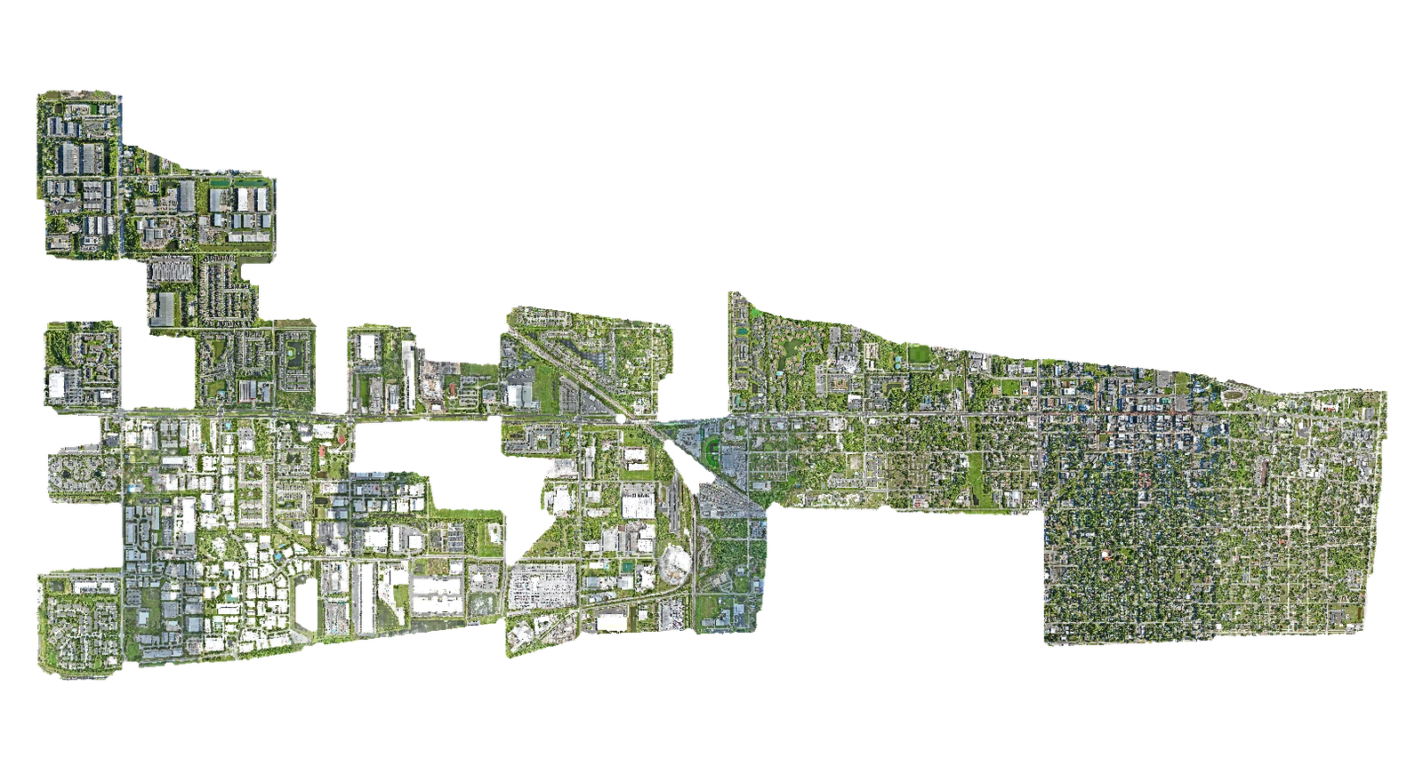
The deliverable's opening image is the coverage overview of the multi-zone mission. The irregular boundary is the actual flight footprint stitched from the captured imagery. The shape itself tells the receiving team something useful: this is a multi-zone capture across a continuous landscape, not a single bounded site.
The Field Workflow
Two field-log templates, one per altitude group. Both fit on a single printed page. Both were filled in at the launch site as each zone completed, not at the end of the day.
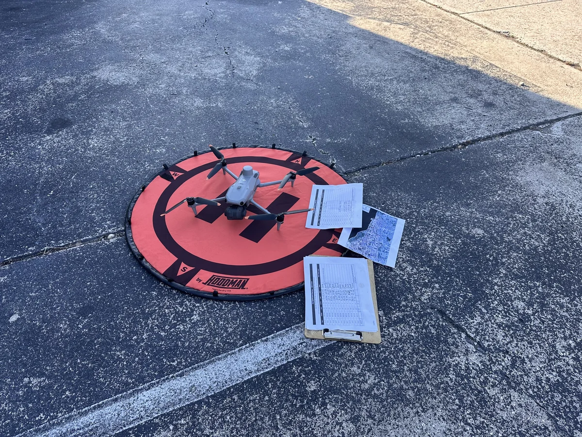
The launch kit at the start of a multi-zone capture day: the aircraft, the landing pad, and the printed field log laid out so the pilot could mark zone status in real time, between launches, without breaking workflow.
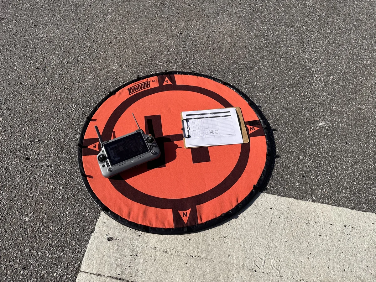
The same field-setup pattern between launches: controller, printed log, and the launch pad kept close together so each per-zone status update was a single-glance operation rather than a context switch away from the aircraft.
Cross-Site Workflow: Two Counties, One Mission
A second project in the same period added a multi-site dimension to the workflow. The two-site project spanned two physical locations in Central Florida: approximately 358 acres across four zones in the Ocala and Marion County area, and approximately 799 acres across seven zones in the Beverly Hills and Citrus County area. Total combined viable acreage was approximately 1,158 acres across eleven zones, all flown at 300 ft AGL.
The two-site mission was managed as one overall delivery with two short field logs, not one long one. The receiving team received two top-level folders, each containing zone subfolders and a per-site manifest, both delivered as a single upload. The per-zone capture discipline was identical to the 27-zone mission, just compressed into a different geographic shape.
The cross-site pattern that worked: capture the first site to completion, then move to the second site, with a fresh field log for each. Two short field logs are easier to keep accurate than one long one, and the audit trail stays clean. The receiving team's review question, "where do I start," has the same answer in both formats: open the manifest, pick a site, walk the zone folders.
The Delivery
The final upload was organized before it left the field. The numbers from the 27-zone mission:
14,535
Completed image files in the upload, across all 27 zones in both altitude groups.
64.5
Approximate data size in GiB delivered as a single upload, organized by zone folder.
27
Named KML zones captured, split across two altitude groups based on airspace restrictions.
Original DJI image filenames were retained. Imagery was grouped by zone and organized by altitude group. A corrected folder label for one zone where the original paperwork carried an altitude typo was made before upload. The final deliverable was not a flat folder dump. It was an organized, zone-indexed image set the receiving team could review by zone, by altitude group, or as a single capture batch.
The Outcome
The mission produced three things that an unstructured capture would not have:
A Reviewable Upload
The receiving team opened the manifest, saw the per-zone breakdown, and was able to start QA on any zone without reconstructing the file structure. The organized delivery was the difference between a 10-minute review start and a half-day folder-sorting session.
An Audit Trail
The field log tied the delivered imagery to specific zones, specific altitudes, specific time windows, and specific field notes (re-flight reasons, weather holds, partial capture flags). The downstream team had a written record of what happened in the field, not a guess.
A Reusable Folder Structure
The zone-indexed, altitude-grouped folder structure is reusable. A future re-flight of any single zone can be inserted into the existing layout without reorganizing the broader deliverable. That reusability is part of the deliverable's value.
What This Project Did Not Claim
Honest scope is part of the deliverable. This project was documentation and planning grade, not survey grade. Specifically, the work was not:
- × A land survey. No boundary lines, property corners, or easement locations were established or marked.
- × An engineering certification. The deliverable is an organized image set for downstream processing, not stamped engineering calculations.
- × A regulatory submission. The imagery is appropriate for operational planning and downstream orthomosaic generation, not for certified reports to environmental regulators or for tax valuation.
- × A topo or boundary guarantee. The PPK positioning produces centimeter-accurate per-image coordinates, but the deliverable is documentation and planning grade, not survey grade.
For work that requires a surveyor's stamp, engineering certification, or regulatory-grade precision, a licensed surveyor or engineer should be engaged.
Related Services
Large-acreage multi-zone aerial mapping is one of the sub-services under our 3D modeling and reality capture pillar. The same workflow supports orthomosaic generation, as-built documentation, and volumetric stockpile analysis.
Orthophoto Mapping
High-resolution, geometrically corrected aerial maps for documentation, planning, and base-map use.
Why Large-Acreage Aerial Mapping Requires More Than a Flight Plan
A practical guide to running large-acreage aerial mapping projects: zones, altitudes, field logs, and delivery.
Citrus Stockpile Volume and Tonnage Mapping
A per-pile volume and tonnage case study on a 300-acre Central Florida grove property.
Frequently Asked Questions
How many KML zones can a single aerial mapping mission cover?
There is no fixed upper limit, but the practical answer is "as many zones as the field log can keep organized." A single pilot can manage 25-30 named zones in a one to three day mission without losing track, especially when the zones are split into altitude groups that act as natural sub-missions. Beyond that, the field log becomes the limiting factor and the receiving team has to reconstruct what happened in the field. For missions above approximately 40 zones, a written field log with discipline on per-zone status updates is the difference between a successful mission and a folder of unsorted imagery.
How does altitude restriction affect the time required for a large-acreage mission?
A 200 ft AGL capture zone takes meaningfully longer per acre than a 300 ft AGL zone. At lower altitude the aircraft covers less ground per pass, generates more flight lines, produces more images, and consumes more battery per acre. A mixed-altitude mission with both altitude groups typically takes 30-50% longer than a single-altitude mission covering the same acreage, depending on the split. The mission plan should split zones by altitude before estimating duration, not after.
How long does a 2,000-plus acre multi-zone aerial mapping mission take in the field?
A multi-zone mission in the 2,000-acre class with mixed altitudes typically runs one to three field days for one pilot, plus pre-flight planning and post-flight processing. A pure single-altitude mission of the same acreage can run faster. Smaller missions in the 500-1,200 acre range usually complete in a single day. Acreage alone does not determine field duration: altitude mix, zone complexity, access points, weather windows, and battery logistics all affect the schedule.
How should the imagery be organized for delivery after a large mapping mission?
Organized by zone, with original filenames retained, and a manifest that confirms image counts and folder completeness. Each named zone should have its own folder, named after the KML zone identifier so the imagery maps directly back to the planning documents. The top-level structure should also reflect altitude groups when the mission had mixed altitudes (one folder per altitude group, each containing its zone subfolders). A flat folder with thousands of images is the single most common delivery mistake and is worth avoiding every time.
Why is a written field log useful on a multi-zone mapping mission?
Without a written record it is easy to lose track of which zones have been completed, which are in progress, which still need a re-flight, and which have field notes tied to them. A field log with columns for zone name, altitude, acres, start time, end time, status, and notes keeps the mission honest. The log also doubles as the QA reference for post-flight processing: when a zone imagery looks off, the field log notes column is the first place the processing team looks to understand why.
Is an aerial mapping deliverable the same as a survey?
No. Aerial mapping produces documentation and planning grade outputs that are appropriate for as-built records, wayfinding, stakeholder reports, marketing collateral, and operational decision support. It is not a substitute for a licensed surveyor with survey-grade equipment when the work requires certified elevations, property boundaries, or stamped engineering quantities. Aerial mapping and survey-grade work are complementary tools, and the right one depends on what the deliverable will be used for.
What should the receiving team expect when they open the deliverable?
A properly organized deliverable is structured so the receiving team can review the work zone by zone without reconstruction. The opening should be a manifest (a list of every zone with image count and total file size), followed by zone-named folders containing the original imagery, organized by altitude group when the mission had mixed altitudes. A copy of the field log is included as the audit trail. A well-organized deliverable takes minutes to review; a flat dump takes hours.
Have a Multi-Zone Aerial Mapping Project?
Tell us about the site, the zones, and the deliverable. We will confirm fit, recommend a scope, and provide a quote within 48 hours.
Contact Us