
Case Study · Orthophoto Mapping
Aerial Campus Directory Imagery for Montverde Academy in Montverde, FL
An orthomosaic and four section-cropped display images for a 130-acre private school campus, prepared for outdoor wayfinding directories. The imagery went from an aerial capture to a finished campus directory that visitors read on-site.
Client
Montverde Academy
Location
Montverde, FL
Campus Size
130 acres
Year
2026
The Project
Montverde Academy is a 130-acre private school campus in Montverde, Florida, serving lower, middle, and upper school students. The school wanted to refresh its outdoor wayfinding system with directory signs that give visitors a clear, at-a-glance understanding of where they are on campus and how to get to the buildings they are looking for.
Ginny Holm, Director of Marketing and Communications, led the project. The school needed a clean, high-resolution set of top-down aerial images of the campus, prepared specifically for static wayfinding displays at multiple on-site locations. The imagery had to be flat, top-down views suitable for large-format digital or printed displays, with all labeling, icons, and final graphic treatments handled internally by the Montverde team.
The referral for the project came through Helen Sneed, who had worked with Skyland Pixels on a previous campus documentation engagement and recommended us to the Montverde team.
The Deliverable
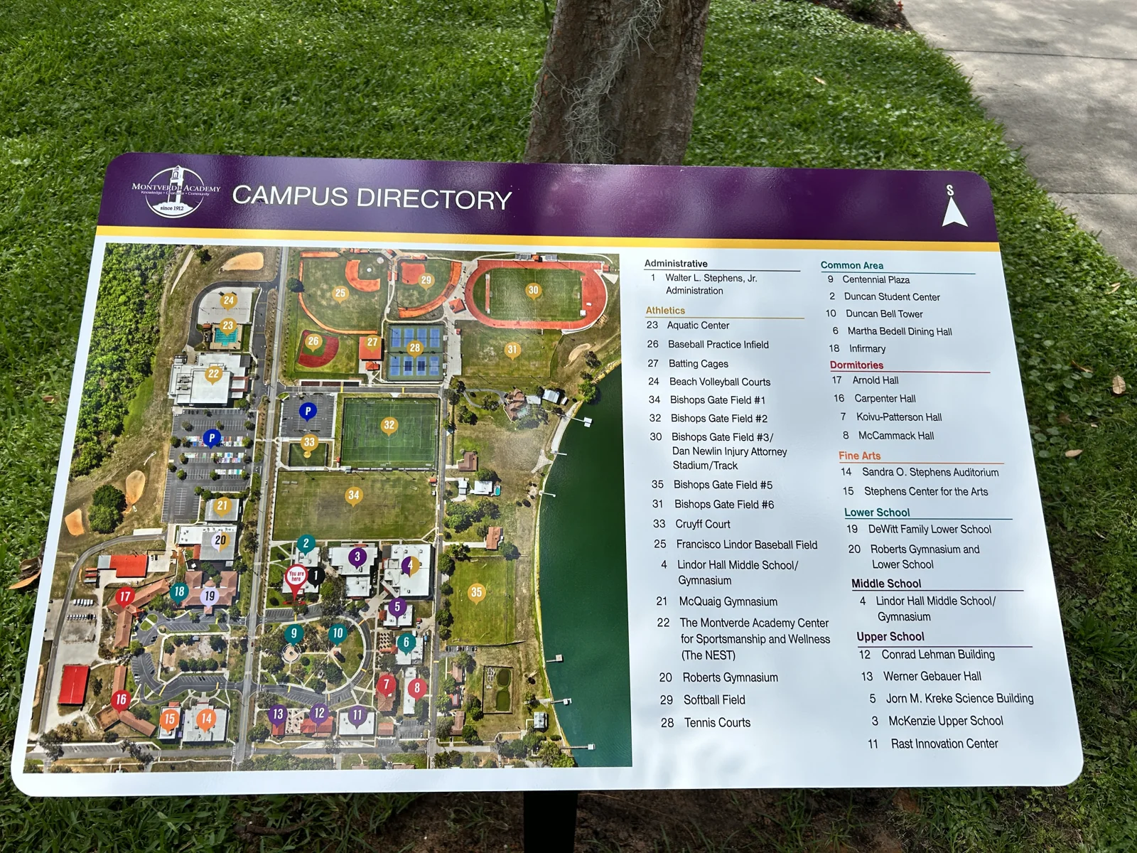
The full processed orthomosaic of the entire 130-acre campus, plus four campus-specific section crops, prepared and color-balanced for static display use. The image below is one of the four section crops as it appears on a finished campus directory sign on-site at Montverde Academy.
The finished on-site directory, captured after installation. The aerial imagery is the base map; the school's marketing and facilities teams handled the labeling, icons, and graphic treatment.
The Full Orthomosaic
The full processed orthomosaic of the campus, delivered as a high-resolution file for the school's reference and records. This is the master file from which the four section crops were prepared.
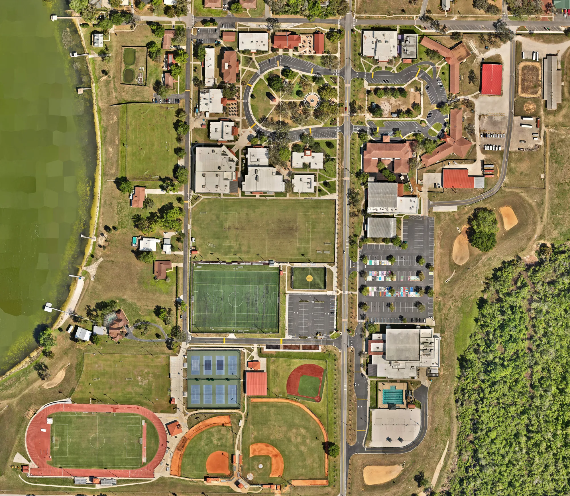
Full campus orthomosaic. Flat, top-down, geometrically corrected. The deliverable is documentation and planning grade, not survey grade.
The Outcome
The deliverable gave Montverde Academy three things they did not have before:
A Finished Wayfinding System
The four display-ready section crops became the base maps for the school's new campus directory signs. Visitors now have a clear, on-site reference for orienting themselves and locating the building they are looking for.
A Reusable Marketing Asset
The full orthomosaic and the section crops are reusable across admissions, marketing, athletics, and facilities. The same imagery that powers the wayfinding system also supports admissions tour presentations and stakeholder reports.
A Dated Campus Record
The orthomosaic is a dated, geo-tagged record of the campus as it stood in early 2026. Future planning conversations (facilities upgrades, capital projects, athletic facility changes) start from this dated baseline.
"Skyland Pixels provided fast, affordable and professional service. The quality is crystal clear and we will definitely be using them again."
On-Site Installation
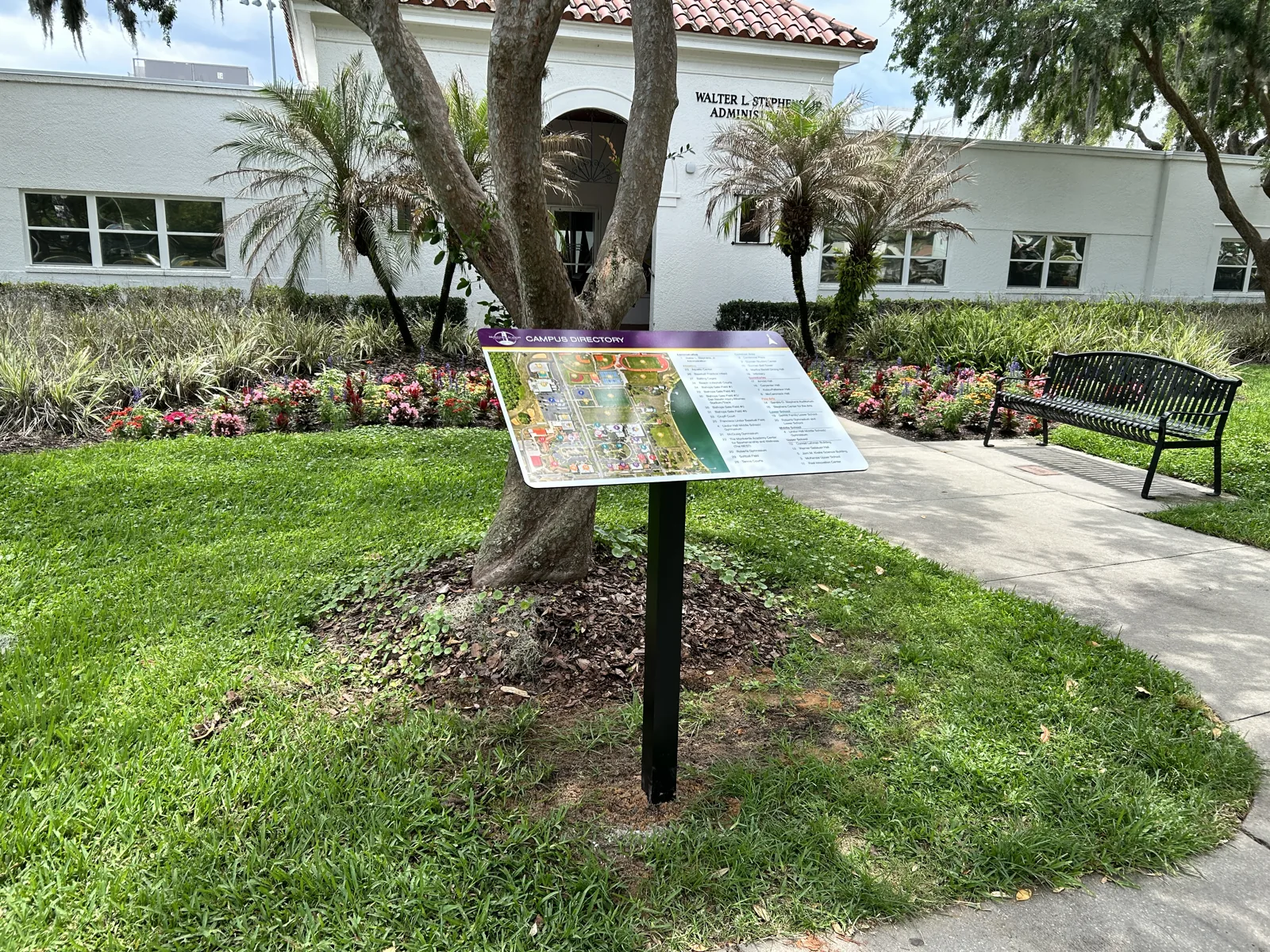
Below is one of the finished directory signs on-site at Montverde Academy, captured in front of the Walter L. Stephens, Jr. Administration building. The aerial section crop is the base map, the school's marketing and facilities teams added the labels, icons, and graphic treatment.
Related Services
A campus orthomosaic is one of the sub-services under our 3D modeling and reality capture pillar. The same workflow supports construction site orthomosaics, as-built documentation, and volumetric stockpile calculations.
Orthophoto Mapping
High-resolution, geometrically corrected aerial maps for documentation, planning, and base-map use. Suitable for static displays, GIS, and CAD integration.
3D Modeling and Reality Capture
Photogrammetry, point clouds, orthomosaics, and volumetrics. Files drop into AutoCAD, Revit, or Civil 3D.
Aerial Construction Photography
Site context, marketing imagery, dated aerial records for commercial construction projects.
Frequently Asked Questions
What is campus wayfinding imagery and how is it used?
Campus wayfinding imagery is a set of static, top-down aerial images of a campus, used as the base map on outdoor directory signs that help visitors orient themselves. Each image is cropped to a defined campus section, color-balanced, and delivered at high resolution for large-format digital or printed displays. The imagery goes from an aerial capture to a finished campus directory that visitors read on-site.
How is orthomosaic imagery different from a regular aerial photo?
A regular aerial photo is a single image with perspective distortion. An orthomosaic is multiple images stitched together and geometrically corrected so that every point in the image is at uniform scale. The result is a flat, top-down, map-like image where building roofs appear in their true plan-view shape, distances are accurate, and the image can be used as a base for measurements, signage, and overlays.
How long does a campus orthomosaic project usually take?
For a 100-150 acre campus, the on-site capture is typically 2-4 hours of flight time plus 60-90 minutes of pre-flight planning and equipment setup. Processing the orthomosaic from the raw flight data takes another 2-6 hours depending on the file size and processing pipeline. Initial deliverables are typically provided within 3-5 business days after the flight, weather and airspace permitting.
What file formats are best for large-format display boards?
For static display boards, high-resolution JPG and PNG files at 150-300 PPI scaled to the final print dimensions are the standard. Full native orthomosaic resolution is usually unnecessary for outdoor display boards, because the boards are viewed at a distance. We deliver display-ready files sized to the print dimensions the school specifies, not the full native resolution.
Is the imagery survey-grade?
No. Orthomosaic imagery from commercial aerial platforms is documentation and planning grade, not survey grade. The proposal explicitly stated that the deliverable is not a land survey and is not for boundaries or design-grade elevations. For survey-grade work, a licensed surveyor with survey-grade equipment is required. The orthomosaic is the right tool for wayfinding, marketing, and planning. Survey work is a different service.
Can the imagery be used for more than wayfinding?
Yes. The same orthomosaic and the same section crops support a wide range of secondary uses: marketing collateral, admissions tour presentations, facilities management planning, board and stakeholder reports, athletics department materials, and capital campaign decks. Many schools commission an orthomosaic for the wayfinding use case and then reuse the same imagery for several other purposes over the life of the asset.
Need a Campus or Site Orthomosaic?
Tell us about your site. We will confirm fit, recommend a scope, and provide a quote within 48 hours.
Contact Us