
Blog · Drone Survey
Drone Survey Orlando: What GC and Developer Teams Need to Know
A working guide to drone survey for commercial construction in Central Florida. What it is, what it delivers, what it costs, and when to use it instead of (or alongside) ground survey and photogrammetry.
Last updated: October 8, 2026
In This Guide
- What Is a Drone Survey for Commercial Construction?
- What Does a Drone Survey Deliver?
- Orlando Airspace and Permitting: What GC Teams Need to Know
- Real Project Example: 2,161 Acres at Hamlin Town Center
- When to Use a Drone Survey vs. Ground Survey vs. Just Photogrammetry
- Pricing for Drone Survey in Orlando
- Drone Survey for Lender Draws and Construction Loan Compliance
- Frequently Asked Questions
What Is a Drone Survey for Commercial Construction?
A drone survey in commercial construction is an aerial data collection of a project site using a Part 107-licensed remote pilot operating an unmanned aircraft. The flight is planned around the project's specific deliverable requirements, with ground control, flight altitude, image overlap, and camera angle tuned to what the project team will use the data for.
The output is a set of georeferenced files that drop into the same software the project team already uses. For most Orlando commercial projects, that means AutoCAD, Civil 3D, Revit, ArcGIS, or QGIS. The deliverable is not a "drone photo" or a marketing video. It is engineering-adjacent spatial data the project team uses for existing-conditions documentation, preconstruction planning, progress monitoring, lender compliance, and stakeholder review.
The work is FAA Part 107-compliant (small unmanned aircraft, commercial operations) and is appropriate for projects where the deliverable is visual-quality and engineering-adjacent rather than survey-grade. For projects that require a Professional Surveyor (PLS) stamp, drone survey work is coordinated with a licensed surveyor rather than substituted for it.
What Does a Drone Survey Deliver?
A standard commercial drone survey produces a bundle of files. The exact deliverable set depends on the project, but a typical bundle for an Orlando commercial project includes:
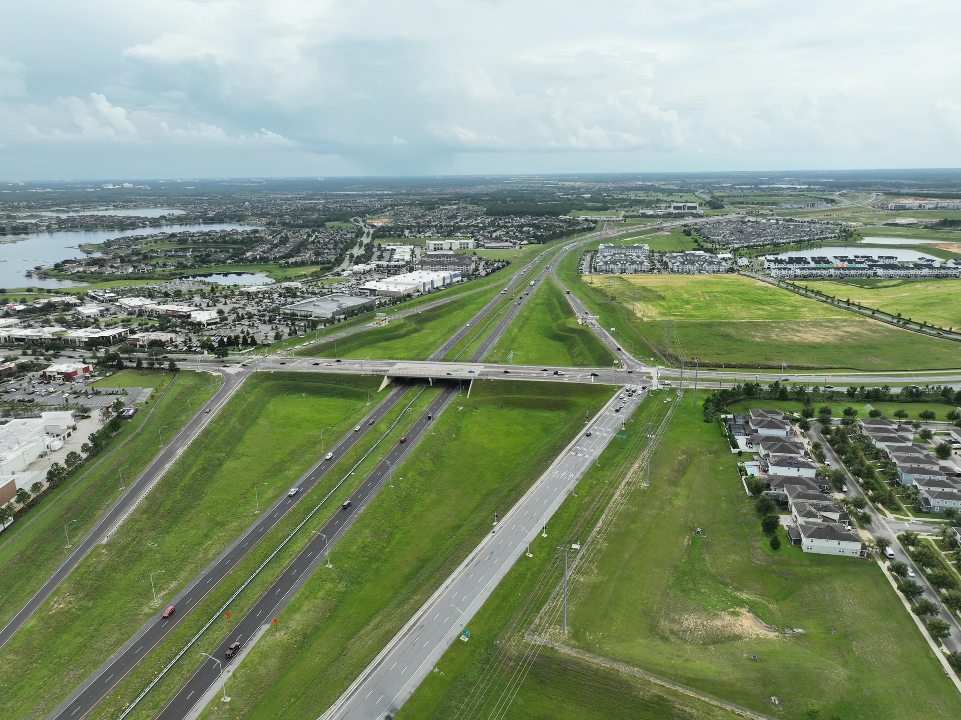
Orthomosaic. A georeferenced, north-up, scaled top-down photo of the entire site at a single moment. Drop into CAD as a base layer. Drop into a stakeholder presentation as the visual reference. Useful for site planning, layout review, and as the visual backdrop for any 2D drawing.
Point cloud (LAS / LAZ). A dense 3D point cloud of the site surface, with each point georeferenced. Used for additional measurement, additional modeling in a separate pipeline, and quantitative analysis (volume, slope, drainage).
Digital Surface Model (DSM). A raster surface of the site, typically delivered as a GeoTIFF. Used for drainage analysis, slope calculations, and as a base layer in GIS platforms (ArcGIS, QGIS, Global Mapper).
Contour lines and breaklines. Delivered in DWG for AutoCAD and Civil 3D, or in LandXML for Trimble Business Center. Contour intervals are typically 1-foot for Florida projects (0.5-meter on request).
Site photos and 360 panoramas. Optional add-ons for projects that need stakeholder-ready visual references for sales centers, owner updates, or marketing.
Written deliverables. A short report describing the flight mission, the equipment used, the processing pipeline, the deliverable bundle, and any conditions or limitations the project team should be aware of. Lender and inspector audiences expect this.
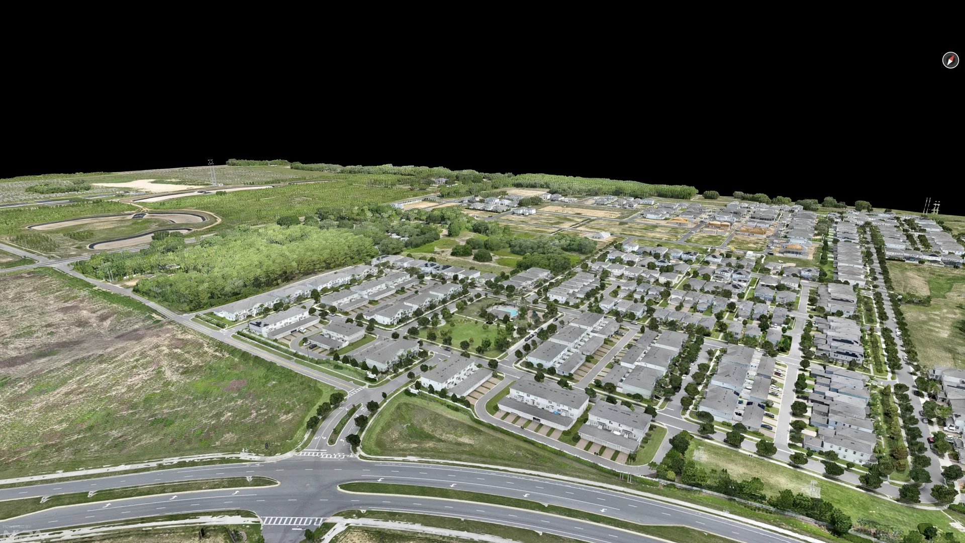
All deliverables are standard GIS / CAD / engineering formats. The project team does not need specialized software beyond what they already have. For projects that need a 3D textured mesh in addition to the standard bundle, that is an add-on and the data is delivered in formats like FBX, OBJ, or glTF.
Orlando Airspace and Permitting: What GC Teams Need to Know
Orlando is one of the more complex drone airspace environments in the country. Walt Disney World, Universal Studios, SeaWorld, Orlando Executive Airport, Orlando International Airport, Kissimmee Gateway Airport, and several stadium and hospital heliports all create LAANC (Low Altitude Authorization and Notification Capability) requirements. Most of the time, the right authorization is one to three days of pre-flight planning through the FAA's LAANC system.
For most commercial projects in the Orlando metro, the standard workflow is: confirm the site coordinates, check the airspace classification, request LAANC authorization if the project falls inside controlled airspace, schedule the flight. The authorization is typically granted automatically within seconds for LAANC-enabled airspace, and the project team does not need to do anything on their end beyond providing the site address.
For projects near Disney or Universal, additional coordination is required. Night flights and flights above 400 feet AGL (Above Ground Level) require separate waivers and additional lead time. The vendor doing the drone survey should handle all of this as part of the project. If your drone survey vendor is asking you to handle airspace authorization yourself, that is a red flag.
Real Project Example: 2,161 Acres at Hamlin Town Center
The largest drone survey we have run to date was a 2,161-acre photogrammetry capture at Hamlin Town Center in Winter Garden, FL, for a creative studio building an interactive 3D sales center experience. The project scope covered the Highway 429 corridor through the site, the adjacent retail frontages, and the surrounding residential neighborhoods. The deliverable was a textured 3D mesh, an orthomosaic, and a point cloud, all stakeholder-ready for a developer's hard sales deadline.
The flight plan was two-zone: 150 feet AGL over the high-resolution area near the highway and retail, 300 feet AGL over the outer ring where the geometry was being used for context rather than for hotspot viewpoints. The center of the site was deliberately omitted because the creative studio was going to full-CGI that area in the final experience. The flight plan mattered because the photogrammetry had to be geometrically clean where it met the open photogrammetry stitched in for the horizon view.
Two days of flying produced 45,438 calibrated photos across 16+ hours of total flight time. The dataset was processed in four to five days into the deliverable bundle, and the entire package was delivered to the creative studio with runway to spare for the developer's lease signing deadline. The full case study is documented at Hamlin Town Center photogrammetry.
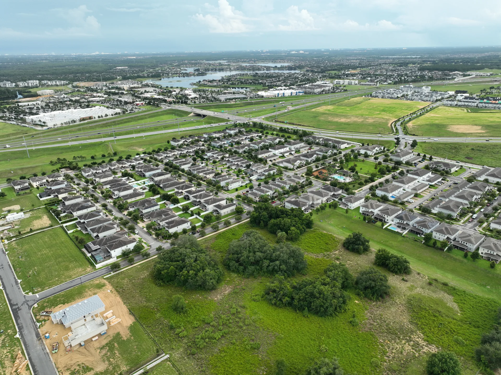
What that project illustrates for drone survey work in Orlando is the scale that is now operationally normal. A 2,161-acre capture, multi-day flight mission, multi-zone flight plan, hard deadline tied to a real estate closing. None of that is theoretical. It is what a competent Part 107 operator with the right equipment can do on a routine commercial engagement in the Orlando market.
When to Use a Drone Survey vs. Ground Survey vs. Just Photogrammetry
The three approaches overlap, and the right choice depends on what the project team needs the data to do.
Drone survey is right when the project needs visual-quality data and engineering-adjacent accuracy for existing-conditions documentation, preconstruction planning, progress monitoring, lender packages, stakeholder review, or as-built verification. Drone survey is faster and cheaper than ground survey, and the deliverable is more complete because the orthomosaic gives the project team a visual record of the entire site at the moment of capture.
Ground survey is right when the project needs a PLS stamp, a legally defensible boundary determination, construction staking to engineering tolerance, or elevation work that requires surveyor-grade accuracy. A drone survey is not a substitute for a PLS in these contexts. The two are coordinated, not competing. For a project that requires a PLS stamp, the drone survey provides the visual and engineering-adjacent layer, and the PLS provides the legally binding layer on top.
Just photogrammetry is right when the project team needs the 3D model and orthomosaic but does not need contours, breaklines, or the CAD-ready surface model. A photogrammetry capture without the survey deliverable bundle is faster and cheaper. If the use case is stakeholder presentation, marketing imagery, or input to a downstream visualization pipeline (Unreal Engine, Unity, Twinmotion), photogrammetry alone is often the right scope.
For most commercial projects, the right answer is drone survey that includes the photogrammetry deliverable as part of the bundle. The cost difference is small, and the project team has the full set of files in case the use case expands.
Pricing for Drone Survey in Orlando
Drone survey pricing in the Orlando market depends on site acreage, airspace authorization complexity, and the deliverable bundle. As a working range for commercial projects in the Central Florida market:
Single-visit existing-conditions survey for a typical 1 to 5 acre commercial site: $450 to $1,500. Includes pre-flight planning, on-site flight, processing, and the standard deliverable bundle (orthomosaic, point cloud, DSM, contours, DWG).
Pre-construction survey for a multi-acre commercial site (10 to 100 acres): $1,500 to $5,000 depending on acreage, deliverable bundle, and airspace complexity.
Large-acreage survey (500+ acres, multi-day flight mission): Quoted per project. The 2,161-acre Hamlin Town Center project was a multi-day engagement with custom processing pipeline.
Recurring drone survey (weekly, bi-weekly, or monthly cadence): Starting at $375 per visit. Volume discounts apply for projects that lock in a multi-month cadence upfront.
Pricing is set per project, not per hour. The pre-flight planning, airspace authorization, on-site flight, processing, and deliverable handoff are all included. There are no separate fees for airspace authorization or for standard processing. Stockpile volume calculations, 3D textured meshes, and other add-ons are quoted separately.
Drone Survey for Lender Draws and Construction Loan Compliance
Most construction lenders will accept drone survey deliverables as supporting documentation at each draw request, provided the deliverable meets a few baseline requirements. The survey must be dated, geo-tagged, and produced by a Part 107-licensed provider with aviation liability insurance. The deliverable must show the project at a specific moment in time, with enough visual context to confirm work-in-place against the draw request.
For GC and developer teams working with construction lenders, the right cadence is typically a drone survey at each draw, with a written narrative describing what is visible in the deliverable and how it corresponds to the work covered by the draw. The cadence is usually aligned to the draw schedule rather than the project schedule. A monthly draw usually maps to a monthly drone survey.
For projects that need to coordinate drone survey directly with the lender, the right vendor can package the deliverable as a lender-facing PDF, with the project team and the lender both on the distribution list. This is the workflow that saves the most time across the draw cycle. The GC project team confirms work-in-place, the drone survey captures the site, the lender package is generated and sent to the lender with the draw request, and the draw is processed.
The lender documentation service is structured around this exact workflow.
Frequently Asked Questions
What is a drone survey in commercial construction?
A drone survey in commercial construction is an aerial data collection of a site using a Part 107-licensed remote pilot operating an unmanned aircraft. The deliverable is typically a georeferenced orthomosaic, a point cloud, a digital surface model, and contour data, all delivered in formats the project team can drop into AutoCAD, Civil 3D, Revit, ArcGIS, or QGIS. The work sits between ground survey and full topographic engineering, and it is the right scope for the preconstruction, existing-conditions, and progress documentation phases of a commercial project where visual quality and turnaround matter more than millimeter accuracy.
How is a drone survey different from drone photogrammetry?
Drone survey is the operational service (a drone flies a site and produces data). Drone photogrammetry is the technical method (overlapping photos processed into a 3D model and orthomosaic). A drone survey almost always uses photogrammetry. The terms get used interchangeably in commercial construction contexts, but drone survey emphasizes the deliverable and the use case, while drone photogrammetry emphasizes the processing pipeline. If you are looking for one vendor to deliver existing-conditions or preconstruction documentation, "drone survey" is usually the more useful search term.
What does a drone survey deliver for a commercial project?
A standard commercial drone survey delivers: a georeferenced orthomosaic (top-down photo, north-up, scaled), a digital surface model (DSM), a point cloud (LAS or LAZ), contour lines and breaklines, and a DWG or LandXML surface model that drops into AutoCAD or Civil 3D. Optional add-ons include stockpile volume calculations, 3D textured meshes for stakeholder presentations, and orthophotos cropped for specific use cases (lender packages, pre-bid submittals, wayfinding directories). The deliverable bundle is delivered within 48 hours of the flight for standard projects.
How much does a drone survey cost in Orlando?
For a commercial project in the Orlando area, a drone survey for existing-conditions documentation typically runs $450 to $1,500 for a single site visit, depending on acreage, airspace authorization, and the deliverable bundle. Pre-construction surveys for multi-acre commercial sites typically run higher. Stockpile volume calculations add $200 to $600 per visit. The price is set per project, not per hour, and includes the pre-flight planning, the on-site flight, processing, and the deliverable. We provide a fixed quote after the project team confirms the site and scope.
How long does a drone survey take from booking to delivery?
Standard turnaround from booking to deliverable is 3 to 7 business days for most commercial projects. The actual on-site flight is typically 60 to 180 minutes depending on the site. The processing pipeline is 24 to 48 hours for a standard site. Same-week delivery is available for most Orlando-area projects, and same-day delivery is possible for time-sensitive pre-bid or lender draws.
Is a drone survey the same as a land survey?
No. A drone survey produces visual-quality and engineering-adjacent deliverables that are appropriate for existing-conditions, preconstruction, progress documentation, lender packages, and stakeholder presentations. A land survey, performed by a licensed Professional Surveyor (PLS) using ground equipment, produces survey-grade deliverables that are appropriate for boundary determination, construction staking, and engineering-grade elevation work that requires a PLS stamp. Drone surveys are faster and cheaper but do not produce legally defensible boundary determinations. For projects that require a PLS stamp, we coordinate with a licensed surveyor.
What airspace authorization is required for a drone survey in Orlando?
Orlando is a complex airspace environment. Downtown Orlando, the theme parks, and several stadiums and airports require LAANC (Low Altitude Authorization and Notification Capability) authorization through the FAA. We handle all airspace authorization as part of the project, including LAANC requests and any required NOTAMs. Projects near restricted airspace (Orlando Executive, Orlando International, Kissimmee Gateway) typically have 24 to 48 hours of pre-flight planning to ensure authorization is in place. The cost of airspace authorization is included in the project quote.
Can a drone survey be used for lender draws?
Yes. Dated, geo-tagged aerial photos and a written progress narrative are exactly what construction lenders expect at each draw. The deliverable from a drone survey is structured so the project team can hand it directly to the lender, package it with the draw request, or have us package it for the lender directly. Lenders typically accept drone survey deliverables as supporting documentation for draw requests when the deliverable is from a Part 107-licensed provider with $1M aviation liability insurance.
Related Services
A drone survey is often combined with related services on the same site visit. The most common add-ons for Orlando commercial projects:
Orthophoto Mapping
Geometrically corrected full-site orthomosaics for sales center displays, wayfinding directories, planning basemaps, and stakeholder presentations.
Aerial Photogrammetry
Textured 3D meshes, orthomosaics, and point clouds for sales center experiences, marketing, and ground-truth source data for downstream visualization.
Volumetric Calculations
Cut and fill volumes, stockpile tonnage, and earthwork quantities from the same aerial capture as the drone survey.
Lender Documentation
Drone survey deliverables packaged as lender-facing PDF reports for construction loan draw requests.
Planning a Drone Survey in Orlando?
Tell us about the site and the deliverable you need. We will confirm fit, recommend a scope, and provide a quote within 48 hours.
Plan a Survey